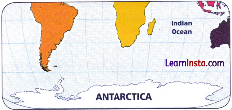
Experts have designed these Class 8 Social Science Notes and Class 8 SST Part 2 Chapter 1 World Geography Some Glimpses Notes for effective learning.
Class 8 World Geography Some Glimpses Notes
World Geography Some Glimpses Notes Class 8
→ Bay: A broad inlet of the sea where the land curves inward, smaller than a gulf.
→ Canal: A human-made waterway connecting two water bodies.
→ Carbon Sink: A natural environment that absorbs and stores more carbon dioxide from the atmosphere than it releases.
→ Cartographer: A person who makes or draws maps.
→ Challenger Deep: The deepest point of the Mariana Trench.
→ Conservation Hotspot: An area with rich biodiversity where special efforts are made to protect plants and animals from threats.
→ Coral Bleaching: The process where corals turn white and die due to changes in water chemistry or temperature, often caused by human actions.
→ Coral Reef: A ridge in the ocean formed by corals that supports a rich variety of marine life.
→ Desert: A large, dry area of land receiving less than 25 cm of precipitation annually.
→ Distortion: The unavoidable misrepresentation of size, shape, or distance that occurs when flattening the Earth’s surface onto a map.
→ Fast Fashion: The quick production of low-cost clothes based on the latest trends, often made in countries with inexpensive labour. These clothes are usually thrown away soon as new fashion styles become popular.

→ Gulf Stream: A powerful, warm ocean current that flows from the Equator through the Atlantic towards Western Europe.
→ Gulf: A large inlet of the sea that cuts deeply into the surrounding land.
→ Map Projection: The process of representing the Earth’s surface on a flat map.
→ Mariana Trench: The deepest ocean trench in the world, located in the western Pacific ocean.
→ Mercator Projection: A map that preserves direction and shape but greatly exaggerates the size of landmasses near the poles.
→ Oasis: A fertile spot in a desert where water is found, typically supporting vegetation and human life.
→ Oblate Spheroid: The Earth’s shape; a sphere that bulges at the equator and is slightly flattened at the poles.
→ Ocean Current: A continuous, directed movement of seawater through the ocean.
→ Ocean Trench: A deep, V-shaped depression on the ocean floor, often formed by tectonic activity.
→ Permafrost: Soil that remains frozen for two or more years; it traps greenhouse gases like methane.
→ Plankton: Microscopic organisms that drift in water and form the base of the ocean food chain.
→ Plateau: A large, high area of relatively flat land that rises sharply above the surrounding area.
→ Rainforest: A dense forest that receives heavy rainfall and supports a great variety of plants and animals.
→ Robinson Projection: A compromise map projection that balances distortion of size and shape to give a more “realistic” view of the Earth.
→ Salt Flat: A large, flat area covered with a layer of salt, formed after water evaporates.
→ Savannah: A tropical grassland ecosystem characterised by wide-open spaces, scattered trees, and seasonal rainfall.
→ Sea: A large body of saltwater that is partially enclosed by land and connected to an ocean.
→ Steppe: A vast, treeless grassland found in temperate regions, with hot summers, cold winters, and moderate seasonal rainfall. It also acts as a natural carbon sink, absorbing and storing carbon from the atmosphere.
→ Strait: A narrow passage of water connecting two larger bodies of water, such as two seas.
→ Swamp: A wet area of land where water covers the ground for most of the year.
→ Tectonic: Related to the internal forces and movements of the Earth’s crust that create mountains and plateaus.
→ Third Pole: A term for the Tibetan Plateau because it contains the largest freshwater reserves outside the North and South Poles.
→ Tundra: A treeless, cold plain where the subsoil is permanently frozen.
→ Water Tower: A mountain region that stores freshwater in the form of glaciers and snow, feeding rivers below.
Introduction
- Rabindranath Tagore, observed that although modern advancements have brought the world geographically closer, they have also made it harder for people to form meaningful human connections.
- The Earth is described as the “blue planet”, not just because of its appearance from space but also because it is seen as a living entity and a nurturing mother, referred to as BhudcvT or Vasudha in various cultural traditions.
- Human life is deeply interconnected with physical geography, meaning that natural features directly affect human existence. For example, the Southern Indian Ocean plays a major role in influencing the monsoon system in the Gangetic Plains, showing how distant geographical features can impact local climates.
- The text sets the stage for a global exploration of Earth’s landscapes, including:
- Towering mountains
- Harsh deserts
- Vast oceans
- It also highlights the importance of physical maps, which help us understand the “language” of the Earth’s surface and navigate its diverse features effectively.
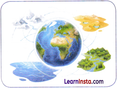
The Complexity of Mapping the Earth
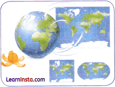
- Representing the Earth on a flat map is difficult because the planet is not perfectly spherical but an oblate spheroid, meaning it is slightly flattened at the poles and bulging at the equator.
- A curved surface cannot be flattened without distortion, similar to trying to spread an orange peel flat without tearing or stretching it, which makes map-making a complex task.
- To address this challenge, cartographers use different types of map projections, but each projection involves some compromise in accuracy.
- Different map projection preserve different features— some represent the shapes of countries more accurately, while others represent their sizes more accurately.
- Examples of projections include:
- Mercator Projection: Useful for navigation because it preserves direction and shape but it greatly exaggerates the size of landmasses near the poles.
- Robinson Projection: Designed to provide a visually balanced representation of the Earth, maintaining a compromise between size and shape.
- Since no single flat map can accurately represent all aspects of the Earth, it is important to:
- Use multiple projections for comparison to understand the world.
- Professionals use maps with latitude and longitude coordinates for precise locations.
The Blue of The Blue Planet, The Oceans
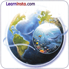
- The Earth is called the “blue planet” because approximately 71% of its surface is covered by oceans, making water the dominant feature of our planet.
- Oceans contain about 97% of Earth’s total water, most of which is saltwater.
- These vast water bodies are extremely important because they:
- Support a wide variety of life forms, ranging from microscopic plankton to massive blue whales.
- Act as a global climate regulators by absorbing and slowly releasing heat.
- Add moisture to the air, helping to form clouds and rainfall.
The underwater world is as diverse as the land, with features such as:
- Mountains
- Valleys
- Plains
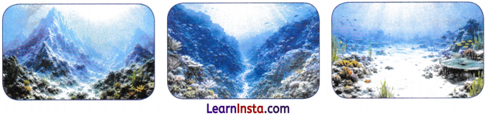
→ The Oceans
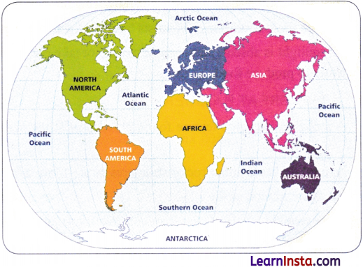
There are five oceans:
- Pacific Ocean – Largest and deepest ocean; home to whales and tuna.
- Atlantic Ocean- Second largest, busiest waterway for trade and transport, and an important fishing ground.
- Indian Ocean – Third largest, warm waters, rich biodiversity, historic international trade route.
- Southern Ocean – Fourth largest, encircles Antarctica; home to penguins and seals.
- Arctic Ocean – Smallest, shallowest, covered with sea ice; home to polar bears and walruses.
→ Ocean Currents
- Ocean currents function like large rivers flowing within the oceans, constantly moving water across different parts of the globe.
- They play a significant role in regulating regional climates and influencing weather patterns.
- Types of ocean currents:
- Warm currents → Carry warm water from the equator towards the poles.
- Cold currents → Carry cold water from the poles towards the equator.
Example:
- This warm current flows from the equator through the Atlantic Ocean towards Western Europe.
- Because of it, countries such as the United Kingdom experience a milder climate compared to other regions at similar latitudes.
→ Ocean Trenches
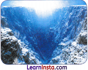
- Ocean trenches are very deep, V-shaped depressions on the ocean floor.
- The most famous example is the Mariana Trench.
- Its deepest point, Challenger Deep, extends more than 11,000 metres below sea level.
- The Mariana Trench is more than 2,000 metres deeper than the height of Mount Everest.
- These regions have extremely harsh conditions, including:
- Complete darkness
- Near-freezing temperatures
- Immense water pressure
- Despite these conditions, scientists have discovered unique life forms in ocean trenches.
- As sunlight is absent, photosynthesis cannot take place. Instead, organisms use energy from chemicals in the ” water to produce food.
→ The Great Barrier Reef
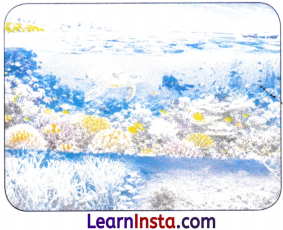
- A reef is an elevated feature found close to or at the ocean’s surface, formed through natural processes or human activities.
- Natural reefs are either rocky structures or are formed by tiny sea animals called corals.
- Reefs are known as the “rainforests of the sea” because they support a great variety of marine life.
- They provide a habitat, food, and shelter for around one-quarter of all ocean species, including fish, crabs, turtles, and sponges.
- Major threats to reefs caused by human activities include:
- Pollution
- Overfishing
- Climate change
- The Great Barrier Reef stretches for over 2,000 km along the northeastern coast of Australia and covers about 350,000 square kilometres.
- It is home to:
- Hundreds of species of corals.
- Thousands of species of fish and other sea animals.
- It is one of the largest and most significant natural ecosystems and is recognised as a UNESCO World Heritage Site.
- Conserving coral reefs is important to protect their rich biodiversity.
- These threats lead to coral bleaching, where corals lose their colour and die due to changes in ocean conditions, resulting in a loss of biodiversity.
→ Smaller Water Bodies and Waterways
- Apart from oceans, there are several smaller water bodies and waterways that are vital for trade, and transport.
- These include:
- Seas → Large saltwater bodies connected to oceans (e.g., Arabian Sea).
- Gulfs → Large inlets of the sea extending deep into the land (e.g., Persian Gulf).
- Bays → Smaller, broad inlets of the sea (e.g., Bay of Bengal, the largest bay and has been important in trade).
- Straits → Narrow natural passages connecting larger water bodies (e.g., Strait of Malacca).
- Canals → Artificial waterways created by humans (e.g., Suez Canal).
- Persian Gulf: An important trade route between India and Europe for thousands of years.
- Bays: Provide safe locations for ports and dockyards by protecting them from strong ocean winds.
- The Suez Canal, opened in 1869, connects the Red Sea and Mediterranean Sea.
- The Suez Canal significantly created a waterway between the Indian Ocean and Europe, revolutionising global trade.
The Continents: Variety on Land
- The major landforms of the Earth include mountains, plateaus, plains, and deserts.
- Mountains are landforms that rise much higher than the surrounding area and have:
- A broad base
- Steep slopes
- A narrow summit
- Plateaus are elevated landforms with a nearly flat surface and often have steep sides.
- Plains are broad, flat or gently rolling areas without large hills or deep valleys.
- Deserts are large, dry regions with very little rainfall and unique plants and animals.
- Hot deserts – Sahara Desert (Africa), Thar Desert (Indian Subcontinent)
- Cold deserts – Gobi Desert (Asia)
- A continent is a large, continuous landmass.
- There are seven continents: Asia, Africa, North America, South America, Antarctica, Europe and Australia.
Table: An Overview of the Seven Continents
| Size (Largest to Smallest) | Continent | Population (approx.) | Area (million km2) | Key Fact |
| 1st | Asia | 4.8 billion | 44.6 | Largest and most populous continent; home to Mount Everest. |
| 2nd | Africa | 1.5 billion | 30.3 | Largest hot desert (Sahara) and longest river (Nile). |
| 3rd | North America | 610 million | 24.7 | Home to the Great Lakes and Rocky Mountains. |
| 4th | South America | 440 million | 17.8 | Home to the Amazon Rainforest and the Andes Mountains. |
| 5th | Antarctica | No permanent population | 14.0 | Largest cold desert, coldest continent, and stores 70% of Earth’s freshwater. |
| 6th | Europe | 740 million | 10.2 | Second smallest continent with many countries. |
| 7th | Australia | 27 million | 7.7 | Smallest continent and only continent that is also a country. |
→ Asia
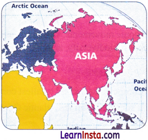
Asia is the largest continent of the world. Some important land features of Asia are as follows:
Roof of the World —The Tibetan Plateau
- The Tibetan Plateau is the highest and largest plateau in the world.
- It is located north of the Himalayan Range.
- It was formed due to the collision of the Indo-Australian and Eurasian tectonic plates.
- It extends nearly 2,500 km east to west and about 1,000 km north to south.
- It has an average elevation of over 4,500 metres.
- It plays a major role in influencing the climate of Asia.
- It is the source of major rivers such as:
- Indus
- Brahmaputra
- Yangtze
- Known as the “Third Pole”, because it contains the largest freshwater reserves outside the polar regions.
- Rising temperatures have increased snow-melt, causing existing lakes to grow larger and new lakes to form.
Gobi Desert in the ‘Land of the Eternal Blue Sky’:
- Deserts are dry regions that receive less than 25 cm of rainfall annually and cover about one-fifth of Earth’s land surface.
- Nearly one billion people live in desert regions according to National Geographic Society.
- The Gobi Desert is located in Mongolia with a part extending into northern China.
- Mongolia is known as the “Land of the Eternal Blue Sky” because it experiences about 8-9 months of sunny weather.
- Temperatures can drop to -30°C in winter, making it extremely harsh.
- The region has sparse vegetation.
- People often follow a nomadic lifestyle, moving with their herds to find pasture supported by underground water sources.
The Eurasian Steppes:
- The Eurasian Steppes are vast grasslands stretching over 8,000 km from west to east.
- It acts as a global carbon sink, absorbing carbon dioxide and helping reduce the greenhouse effect.
- It also serves as a resting ground for migratory birds, such as the Siberian crane.
The Urals:
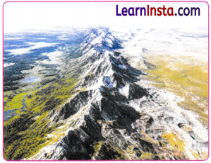
- The Ural Mountains form a natural boundary between Europe and Asia.
- These mountains stretch for about 2,500 km, from the Arctic Ocean to Kazakhstan, and are rich in minerals such as:
- Gold
- Iron ore
- Oil
- Coal
- Zinc
- Natural gas
- Platinum
- Copper
- They form a natural boundary between Europe and Asia.
- The range is known for its rugged slopes, caves, valleys, and forests.
- They support diverse ecosystems including:
- Deciduous forests
- Coniferous Taiga forests
- These forests provide habitats for animals such as brown bears, wolves, lynx, elk, reindeer, and sable.
- The Urals have diverse landscapes, ranging from northern tundra and swamps to fertile southern farmlands, making them important for their rich biodiversity, scenic beauty, and economy.
Mountains (Water Towers):
Tectonic movements, volcanoes, and erosion create mountains. They influence the climate, act as water towers, | support biodiversity, and often form natural boundaries between countries.
→ Europe
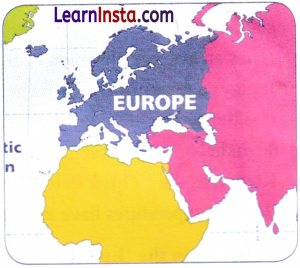
- Europe is the second smallest continent of the Earth.
- It stretches from the Atlantic Ocean in the west to the Ural mountains in the east.
The European Plain:
- The European Plain is one of the largest flatlands in the world.
- It is characterised by low-lying land, gentle rolling hills, and broad river valleys.
- Its fertile soil, makes it one of the world’s most productive agricultural regions, where crops such as wheat, barley, rye and potatoes are widely grown.
- Its rivers have played an important role in trade and transport.
- The region is rich in resources such as coal, oil, natural gas.
- Its flat terrain and favourable climate have supported the growth of major cities such as Paris, Amsterdam, Moscow, Berlin, and Warsaw.
- The European Plain has witnessed many major battles and remains important for Europe’s agriculture and transport.
- The Alps are a crescent-shaped mountain range in south-central Europe.
- They form a natural barrier and are famous for their beautiful landscapes, skiing, hiking, and the peak of Mont Blanc.
- The Alps are home to diverse forests, alpine flowers, and wildlife such as brown bears, wolves, and golden eagles.
- The Alps provide water to major rivers such as the Rhine and the Danube, supplying drinking water, irrigation, and hydroelectric power.
- The region is also rich in minerals, forests, and fertile land.
→ Africa
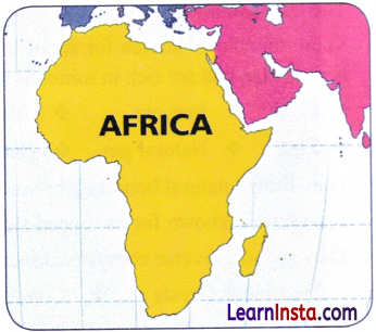
- Africa is the second largest continent of the world.
- Africa has a variety of landforms, including deserts, grasslands, and rivers.
- The Sahara Desert is the largest hot desert in the world, with temperatures ranging from 30°C to 46°C, less than 25 cm of rainfall and very little vegetation.
- The Sahara has long been home to nomadic tribes who rear sheep, goats and camels and depend on trade for their livelihood.
- Ancient trade routes across the Sahara carried gold, salt and ideas to the Mediterranean world.
- The African Savannah is a tropical grassland rich in wildlife like lions and elephants, but it is threatened by human activities like, farming, deforestation and climate change.
- The Nile River, at 6,500 km, is the longest river in the world.
- It supported ancient Egyptian civilisation and remains a vital lifeline for irrigation, transport, drinking water, fishing and hydroelectric power.
→ South America
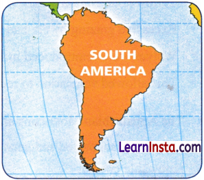
- The Andes Mountains are the largest mountain range in South America.
- The Andes include Mount Aconcagua, the highest peak in the Western Hemisphere, and Bolivia’s Uyuni Salt Flats, the world’s largest salt flat.
- The Andes supply water to the Amazon River, the largest river in the world by volume.
- The mountains support a rich variety of wildlife, with many species found only in this region.
- Only about one-fourth of the original flora and fauna remains, making the Andes an important conservation hotspot.
- The region is also rich in minerals such as silver, zinc, copper and lithium.
- The Atacama Desert in Chile is one of the driest places on Earth, stretching about 1,000 km.
- Temperatures in the Atacama Desert range from about 40°C during the day to 5°C at night.
The Amazon River and Rainforest:
- The Amazon River begins in the Andes Mountains of Peru and flows eastwards into the Atlantic Ocean, making it the longest river in South America.
- Its basin and tributaries nourish and support the Amazon Rainforest.
- Nearly 400 indigenous communities live in the rainforest and help conserve it.
- Deforestation and climate change threaten the Amazon Rainforest.
- Winds carry phosphorus-rich dust from the Sahara Desert to the Amazon, supplying essential nutrients to rainforest plants.
The Atacama Desert:
- The Atacama Desert is known for its clear night skies, making it one of the best places for stargazing.
- Its rocky, Mars-like landscape is used by NASA to test rovers.
- The desert has also become a major dumping ground for discarded clothes due to the growth of fast fashion.
- The United Nations (UN) has described this as an environmental and social emergency.
→ North America
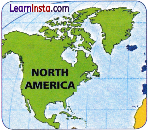
North America is the third largest continent of the world.
The Colorado Plateau:
- The Colorado Plateau is a highland region in the southwest United States, famous for the Grand Canyon.
- It was formed by tectonic uplift and millions of years of erosion, creating striking red rock formations and deep canyons.
- The region is rich in natural resources such as coal, oil, natural gas, uranium, and copper.
- Its unique landscapes and geology make it an important tourist destination.
- The Rocky Mountains extend about 4,800 km and are rich in minerals like, gold, silver and copper.
- Mining, hydropower, tourism, and agriculture contribute to the region’s economy.
- The Rockies were once home to large Native American communities, many of whom now live on reservations.
- The Appalachian Mountains are among the oldest mountain ranges in the world.
- They have supported indigenous communities and are important for coal, timber, tourism, natural gas and renewable energy.
- The Great Lakes are a chain of five freshwater lakes, important for shipping, drinking water, commerce and wildlife but face environmental challenges.
National Park:
- Yellowstone National Park is a well-known example of ecosystem restoration.
- Excessive grazing by elk had disturbed the natural balance of the ecosystem.
- Wolves were reintroduced in 1995 to control the elk population.
- This allowed vegetation to recover and helped restore ecological balance.
→ The Australian Continent
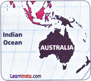
- Australia is the smallest continent on the Earth.
- A large part of Australia is arid and known as the Great Australian Desert. It includes areas such as the Great Victoria Desert.
- It supports unique wildlife, including:
- Wallabies
- Dingoes
- Feral camels
- It is also home to rare animals such as the sandhill dunnart, marsupial mole and mallee fowl, many of which are struggling to survive.
- The indigenous Spinifex people have lived here for over 25,000 years.
- The desert region attracts tourist for its unique geography, wildlife and the preserved culture of the Spinifex.
→ Antarctica
- Deserts are not always hot; some are cold as well.
- Antarctica is the largest and coldest desert on Earth, covering over 14 million square kilometres, more than four times the size of India.
- It is even colder than the Arctic, the Earth’s other polar desert.