Experts have designed these Class 7 SST Notes Chapter 1 Geographical Diversity of India Class 7 Notes for effective learning.
Class 7 Geographical Diversity of India Notes
Class 7 SST Chapter 1 Geographical Diversity of India Notes
Class 7 SST Chapter 1 Notes – Geographical Diversity of India Notes Class 7
→ Legend: Legend is like a little guide, shown in the right side, at the bottom of a map. It depicts what the symbols and colours given in a map mean.
→ Himalaya: Himalaya is a sanskrit word which is made by combining two words Him and Aalaya. Him means snow and Aalaya means abode. In this way, Himalaya means “abode of snow’.
→ Terrain: Terrain means a layout of the land, it can be rocky, flat, hilly etc.
→ Tso: Lake.
→ Eurasia: Eurasia means a huge land mass that includes both Europe and Asia.
→ Dunes: Dunes are hills of sand.
→ Arid: Arid is a super dry region, where it hardly rains. It is like a desert.
→ Ridges: Ridges are long, narrow strips of high land.
→ Plateau: A plateau is a big, flat, mountain top. It looks like a table. In other words, A landform which rises up and has more or less flat surface. Often, some of its sides has steep slopes.
→ Peninsula: It is a triangular piece of land, which is surrounded by water bodies on three sides.
→ Coral reefs: Coral reefs are underwater cliffs which were built by tiny marine animals called corals.
→ Estuaries: An estuary is a place where a river meets the sea. It is a mix of fresh and salt water.
→ Deltas: Deltas are triangular landforms, formed by the deposition of sediments into a large water body. it is formed near estuaries.
→ Archipelago: Group of islands.
→ Tributaries: Smaller streams of river that flow into a larger river.
Example: River Yamuna is a tributary of river Ganga.
Geographical Diversity of India Class 7th Notes
- India is the 7th largest country in the world.
- Due to its distinct geographical location, India, along with its neighbouring countries, is collectively known as the Indian subcontinent.
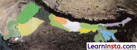
- Our country has five geographical regions.
- The Himalayas (the Great Mountain zone).
- The Gangetic Plains (Plains of the Ganga and the Indus).
- The Thar Desert
- The Southern Peninsula
- The Islands
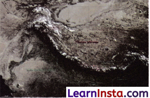
The Himalayas
The Himalayas are world’s highest mountain range, with Mount Everest as the highest peak. They are source of major rivers including the Ganges, the Brahmaputra and the Indus which provide water for agriculture, drinking and industries.
The Himalayas are considered sacred with various temples and monasteries, which attracts lots of people seeking spiritualism.
How the Himalayas were formed… an interesting story.
- Millions of years ago, India was a part of Gondwana land near Africa.
- It broke away and began drifting slowly northwards. It reached the landmass of Eurasia and collided with it. The force of the collision caused the land between them to fold and rise, forming the Himalayan mountain range.
![]()
Ranges of Himalayas
→ The Himadri (The Greater Himalayas) is the highest part of the Himalayas with towering peaks like Mount Everest and Kanchenjunga. Here life is tough and there is no human settlement, as mountains are covered with snow throughout the year.
→ The Himachal (The Lower Himalayas) are towards south of the Greater Himalayas, with moderate climate due to which human settlement is possible along with rich flora and fauna. Many famous hill stations like Darjeeling, Nainital, Shimla, Mussoorie, are located in the Lower Himalayas.
→ The Shivalik (The Outer Himalayas) is outermost and lowest range, further down south of The Lower Himalayas. They serve as a transition zone between the Gangetic Plains and the Himalayas. These foothills have rolling hills with dense forests and rich wildlife. For instance, Jim Corbett National Park lies in the Shivalik range.
The Cold Desert of India
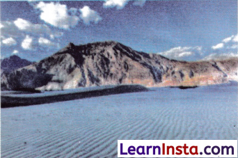
- Ladakh is known as a cold desert, where temperature drops below -30°C in winters.
- It has a rugged and rocky terrain with deep valleys and high mountains.
- It gets very little ram and stays dry most of the time.
- It is called “moonland”.
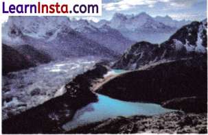
- Ladakh is also known for its beautiful lakes like Pangong Tso.
- Unique wildlife such as snow leopard, ibex and Tibetan antelopes are found here.
- Ancient monasteries and colourful festivals like Losar and the Hemis festival form the cultural identity of this place.
The Gangetic Plains
- Fertile gangetic plains lie to the south of the Himalayas.
- This region is nourished by three mighty river systems.
- The Ganga
- The Indus
- The Brahmaputra
- These rivers enrich the soil with minerals, making it highly fertile and ideal for agriculture.
- They are also a source for generating electricity.
- These northern plains are ideally suited for development of roads, industries and infrastructure.
The Great Indian Desert or Thar Desert
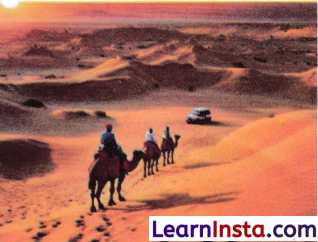
- The Thai Desert is located on the western side of our country.
- Main features of this terrain are golden sand dunes, rugged landscapes and a wide open sky.
- The Thai is a vast arid region that spans the states of Rajasthan, Gujarat, Punjab and Haryana.
- Harsh climatic conditions such as high daytime temperatures, cold nights, and water scarcity, restrict the movement of both animals and humans. These conditions act as a natural barrier.
The Aravalli Hills
- The Aravallis are among the oldest mountain range (2.5 Billions Years old) in the, world, with Mount Abu in Rajasthan as the highest peak.
- The Aravallis acts as a natural barrier between the Thar desert and the Indian peninsula towards east.
- The Aravallis range is also rich in granite stone, marbles and minerals (Zinc and copper).
- Famous and historic forts (Chittorgarh, Kumbhalgarh and Ranthambore) lies in the Aravallis.
The Peninsular Plateau

- The Peninsular Plateau is a triangular peninsular region in central and southern India.
- This plateau is surrounded by the Bay of Bengal in the east, the Arabian sea in the west and the Indian Ocean in the south.
- Two major mountain ranges, the Western Ghats and the Eastern Ghats border this plateau.
- The region has rich mineral resources, dense forests and fertile land making it economically significant.
- East flowing rivers such as the Godavari, Mahanadi, Krishna and Kaveri drain into the Bay of Bengal.
- West flowing rivers like Narmada and Tapti drain into the Arabian sea.
- Many beautiful waterfalls attract tourists, which also helps in generating hydroelectricity and provide for irrigation.
![]()
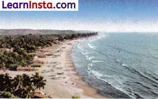
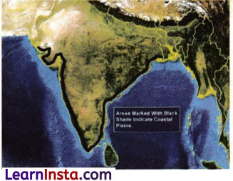
India’s Amazing Coastline
- India’s coastline has beautiful beaches, rocky cliffs, and lush green forests.
- It stretches over 7,500 km.
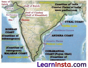
The West Coast of India
- It stretches from Gujarat to Kerala passing (through) Maharashtra, Goa, and Karnataka.
- The rivers Narmada and Tapti form estuaries (An estuary is a coastal area where fresh water from river mixes with saltwater from the sea) here.
- This coastline is shaped by alluvial deposits from short rivers and features such as coves, creeks and estuaries.
- There are many important ports and cities on the western coast, which are centre of economic activities for last many years.
The East Coast
- It stretches from the Ganga Delta to Kanyakumari.
- It has wide plains and major river deltas.
- The rivers the Godavari, the Kaveri, the Krishna and the Mahariadi form fertile deltas, creating an ideal landmass for agriculture.
- Chilika Lake and Pulicat Lake are located along this coast. Both lakes are lagoons. (Lagoon is a lake of saltwater that is separated from the sea by sand or rock.)
INDIAN ISLANDS

Lakshadweep Islands
- This island is situated in the Arabian sea near Malabar coast of Kerala.
- It is a group of 36 islands formed from coral.
- In few islands there is no population.

Andaman and Nicobar Islands
- This island is a combination of 500 large and small Volcanic islands.
- It is divided into two groups.
- The Andaman islands
- The Nicobar islands

- This region is rich in wide variety of flora and fauna.
- Many of our freedom fighters were jailed in “Cellular Jail” here.
The Delta in West Bengal and the Sundarbans

- The Sunderbans is situated in the delta of the Ganga, the Brahmaputra and their tributaries.
- This delta is a unique combination of a river, sea and land.
- Sundarbans is a UNESCO heritage site.
- The main species of the Sunderbans is the Royal Bengal Tiger.
The hills of the Northeast
- Northeast hills are part of the Meghalaya Plateau, known for heavy rainfall, waterfalls and lush greenery.
- Garo, Khasi and Jantia are important hills of this region.
- Mawsynram, the highest rainfall region, is also located here.
- This region receives one of the highest rainfalls in the world.